Video of the presentation in Cyprus:

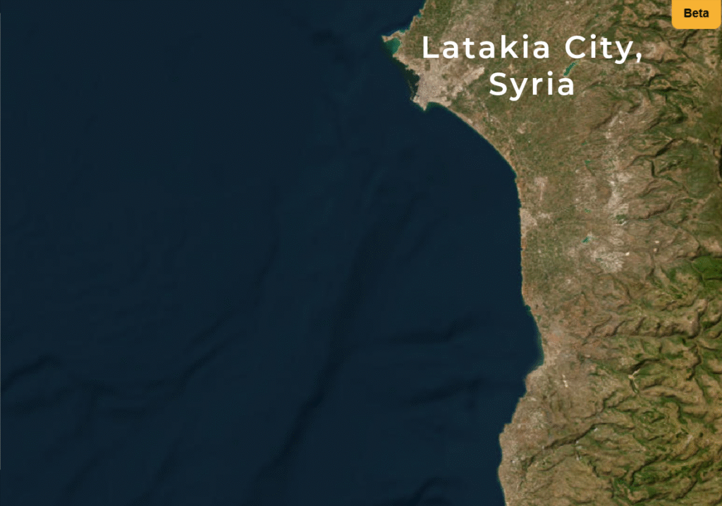
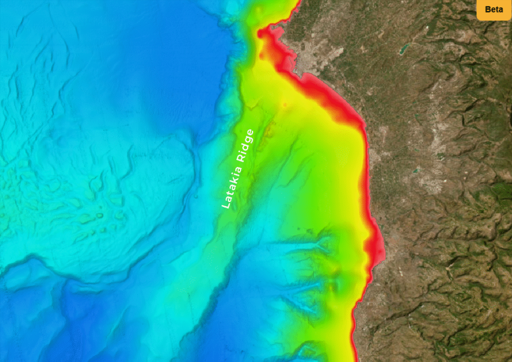
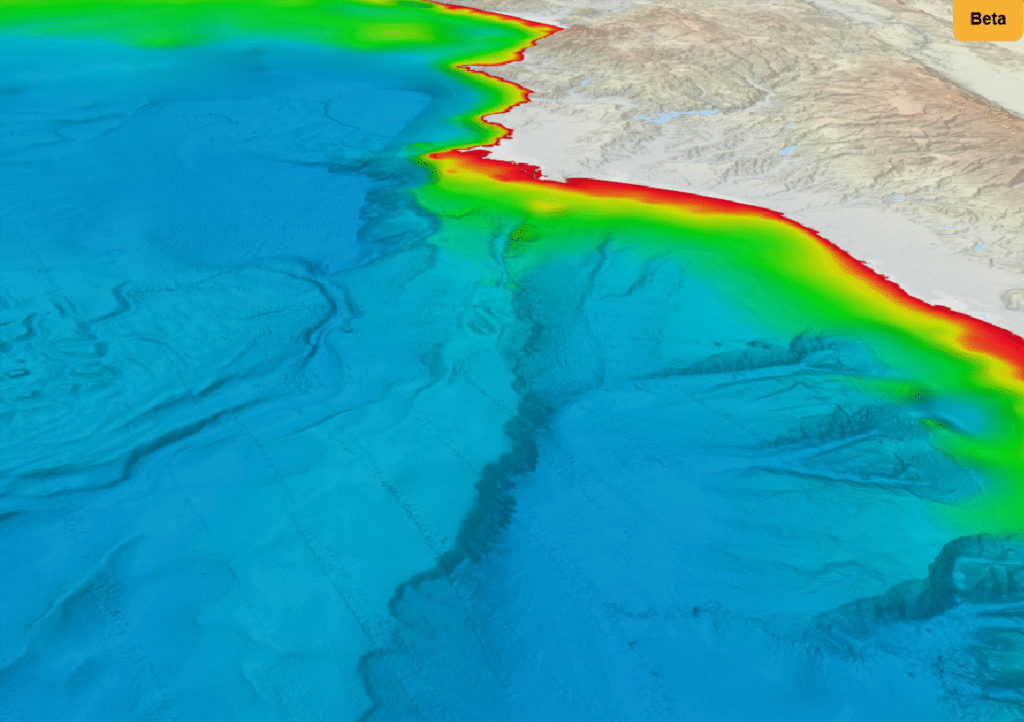
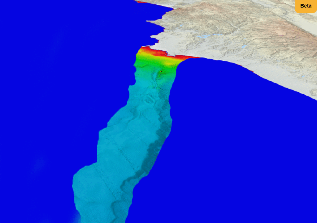
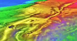
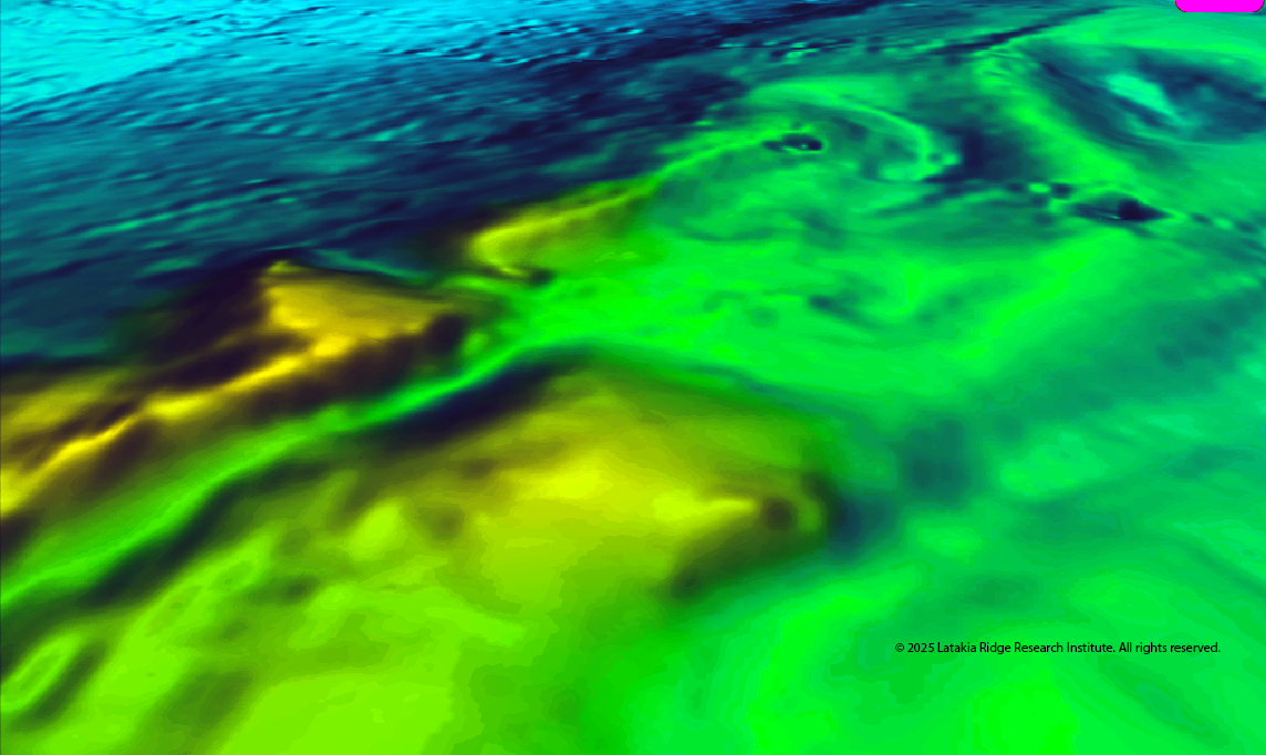
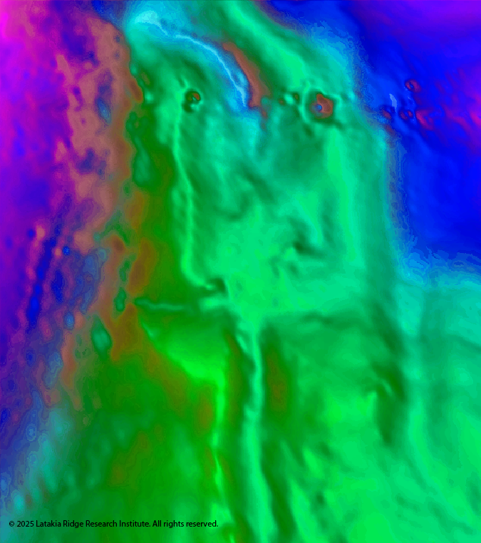
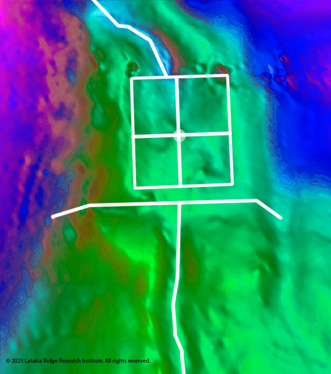
Five hundred meters down in the Eastern Mediterranean, twenty miles off the coast of Syria, lies a submerged landscape that—by all accepted geological models—should not exist. High-resolution terrain models of the Latakia Ridge reveal razor-straight lines, right angles, terraces, and channel systems extending across kilometers of seafloor. The precision of these features contrasts sharply with the irregular, chaotic patterns typical of natural marine terrain and raises questions that demand careful scientific investigation.
Many of these features appear statistically unlikely based on known submarine processes. Natural seafloor formation rarely generates rectangular platforms, cardinal alignments, or intersecting trench networks with such precision. Yet AI-assisted analysis highlighted these patterns across multiple independent datasets, exposing a level of spatial coherence not previously visible in raw bathymetry. Remarkably, several of these anomalies can be seen on standard bathymetric maps, but they only emerge in full clarity through algorithmic detection and 3D terrain analysis.
Now available worldwide, The Sunken Peninsula presents the complete discovery, imagery, measurements, and analytical reasoning behind this submerged geometric landscape—and outlines the next steps needed to investigate it directly through cores, ROV imaging, and higher-resolution mapping.
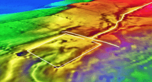
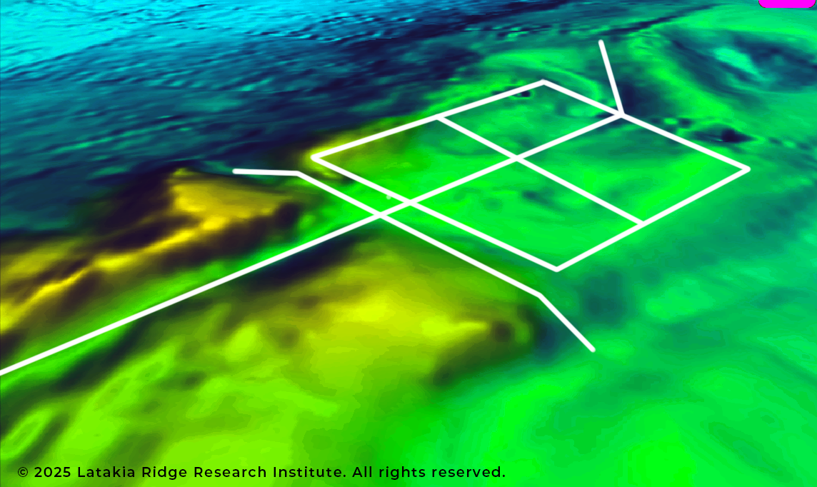
AI-assisted terrain analysis revealed the following key features on the summit:
- A perfectly flat rectangular platform with sharp, unnatural-looking edges.
- A surrounding moat-like depression tracing the outer boundary of the platform.
- Long, straight ridges and trenches running with almost no curvature.
- Multiple 90-degree angles, especially where channels and edges intersect.
- A straight, evenly sized canal running across the summit.
- An elevated, meandering channel that crosses the platform like an aqueduct.
- Two reservoir-like basins, symmetrically placed and connected to the canal system.
- Terraced slopes below the platform, forming step-like levels.
- Clear north–south and east–west alignment of major features.
- A raised berm or rim around the outer boundary.
- Small dome-like bumps nearby, possibly covering buried structures.
- Different seafloor texture and composition compared to the surrounding area.
Taken together, these features form a coherent geometric landscape unlike any known natural seafloor terrain.
The combination of these elements—present on a single summit—warrants targeted scientific investigation, including core sampling, ROV imaging, and higher-resolution bathymetric mapping to determine their origin.